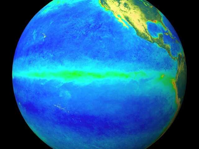
MELBOURNE, Australia – El Niño persists, although a steady weakening trend is evident in the oceanic indicators, reports the Bureau of Meteorology of the Australian Government in its latest update. Sea surface temperatures in the central tropical Pacific and temperatures in the Pacific sub-surface show a clear cooling trend, in line with typical event decay.
Atmospheric indicators have been mixed over the past fortnight; cloudiness near the Date Line has increased, while the 30-day Southern Oscillation Index (SOI) has returned to negative values (both characteristic of an El Niño state).
This is expected to be a temporary fluctuation (often observed during summer) and most likely the result of the slow-moving Madden Julian Oscillation in the region.
International climate models suggest the central tropical Pacific Ocean will continue to cool in the coming months, with four of seven climate models indicating the central Pacific is likely to return to neutral El Niño–Southern Oscillation (ENSO) levels in April (i.e., neither El Niño nor La Niña), and all models neutral in May.
ENSO predictions made in late summer and autumn tend to have lower accuracy than predictions made at other times of the year. This means that current forecasts of the ENSO state beyond May should be used with caution.
Based on the historical record from 1900, around 50% of El Niño events have been followed by a neutral year, and 40–50% have been followed by La Niña. However, global oceans have warmed significantly over the past 50 years. The oceans have been the warmest on record globally between April 2023 and January 2024. These changes may make a difference when predicting future ENSO events based on historical activity.
The Indian Ocean Dipole (IOD) is neutral. The majority of model forecasts indicate the IOD will be neutral until at least April, consistent with the annual cycle of the IOD.
The Southern Annular Mode (SAM) index is currently positive as at 17 February. Forecasts indicate the SAM index will fall briefly to negative SAM levels over the coming week, and then back to neutral SAM levels for the remainder of the coming fortnight. Neutral SAM has little influence on Australian rainfall patterns.
The Madden–Julian Oscillation (MJO) has weakened significantly in the central Pacific Ocean in the past week and is now weak or indiscernible. All international climate models indicate the MJO will remain weak in the coming week, with some models suggesting a strengthening in Maritime Continent at the start of March.
The global mean temperature for the 12 months February 2023 to January 2024 was the highest on record, with Copernicus reporting that it was 1.52 °C above the 1850–1900 pre-industrial average.
However, the magnitude of global warming is assessed using multi-year averages, and a single 12-month period does not mean that the 1.5 °C target referred to in the Paris Agreement has been exceeded.


