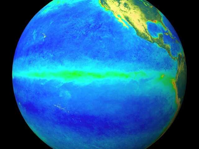
MELBOURNE, Australia – The ENSO Outlook remains at El Niño Alert, informs the Bureau of Meteorology of the Australian Government (BOM). When El Niño Alert criteria have been met in the past, an El Niño event has developed around 70% of the time. Central and eastern Pacific sea surface temperatures (SSTs) are exceeding El Niño thresholds. Models indicate further warming is likely, with SSTs remaining above El Niño thresholds until at least the end of the year.
The past month has seen the Southern Oscillation Index (SOI) shift back to neutral levels, with the 30-day SOI at +3.9 for the 30 days ending 16 July.
The 90-day SOI is outside El Niño thresholds at -5.2. Sustained changes in wind, cloud and broad-scale pressure patterns towards El Niño-like patterns have not yet been observed. This means the Pacific Ocean and atmosphere have yet to become fully coupled, as occurs during El Niño events. El Niño typically suppresses winter–spring rainfall in eastern Australia.
The current status of the ENSO Outlook does not change the long-range forecast of warmer and drier conditions across much of Australia for August to October. The Bureau’s climate model takes into account all influences from the oceans and atmosphere when generating its long-range forecasts.
The Indian Ocean Dipole (IOD) is currently neutral. All models suggest a positive IOD is likely to develop in late winter or early spring. A positive IOD typically decreases winter–spring rainfall for much of Australia.
The Madden–Julian Oscillation (MJO) is currently weak, but some models indicate it will strengthen in the eastern Maritime Continent or Western Pacific region in the coming fortnight. Should this eventuate, this may contribute to El Niño development by weakening trade winds. However, around half of the surveyed models indicate no significant strengthening of the MJO in the next 2 weeks.
The Southern Annular Mode (SAM) index is currently negative and is expected to return to neutral values towards the end of July. A negative SAM during winter typically increases rainfall for parts of south-west and south-east Australia, while a neutral SAM has little influence on Australian climate.
Global warming continues to influence Australian and global climates. SSTs have been the warmest on record (since 1900) for each month since April. Extreme heatwave conditions across the northern hemisphere start of July resulted in the world’s hottest week on record (using preliminary analyses of daily surface air temperature over land and oceans). sea ice extent is at a record low for this time of year (using daily observations beginning in 1979).
Australia’s climate has warmed by an average of 1.47 ± 0.24 °C since national records began in 1910. There has also been a trend towards a greater proportion of rainfall from high intensity, short duration rainfall events, especially across northern Australia. Southern Australia has seen a reduction, by 10 to 20%, in cool season (April to October) rainfall in recent decades. This is due to a combination of natural variability on decadal timescales and changes in large-scale circulation caused by an increase in greenhouse gas emissions.


