MELBOURNE, Australia – The Indian Ocean Dipole (IOD) index has been very close to or exceeded negative IOD thresholds (i.e. at or below −0.4 °C) over the past four weeks, meaning a negative IOD event is increasingly likely in 2022. All climate model outlooks surveyed indicate a negative IOD event is likely for the coming months.
A negative IOD increases the chances of above average winter–spring rainfall for much of Australia. It also increases the chances of warmer days and nights for northern Australia.
Sea surface temperatures are currently warmer than average around much of the Australian coastline, particularly to the north and west. This pattern is likely to increase the chance of above average winter–spring rainfall for Australia.
The 2021–22 La Niña event has ended. However, observations and climate model outlooks suggest La Niña may re-form later in 2022. As a result, the Bureau’s ENSO Outlook status is at La Niña WATCH. La Niña WATCH means there is around a 50% chance of La Niña forming later in 2022. This is approximately double the normal likelihood. La Niña events increase the chance of above average winter–spring rainfall across much of northern and eastern Australia.
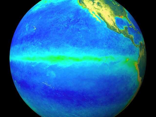
El Niño–Southern Oscillation (ENSO) indicators are mostly at neutral levels. Tropical Pacific sea surface temperatures have continued to warm and are now mostly close to average levels. Similarly, beneath the surface, water temperatures are close to average, or slightly warmer than average in the east. Trade winds are also generally close to average strength. However, some atmospheric indicators continue to show a La Niña-like signal, including cloudiness near the Date Line and the Southern Oscillation Index (SOI).
Most climate models surveyed by the Bureau indicate ENSO is likely to remain neutral through the southern hemisphere winter. Four of the seven models surveyed by the Bureau suggest La Niña could return in spring, with the remaining three models persisting at neutral ENSO levels.
The Madden–Julian Oscillation (MJO) is currently in the western Maritime Continent region. Models suggest this MJO signal is likely to weaken in the coming days. The MJO in this region typically enhances rainfall over parts of north-east Australia and the northern Maritime Continent, and can also strengthen trade winds over the tropical Pacific. If the MJO pulse weakens as forecast, its influence on rainfall and wind patterns is expected to diminish.
The Southern Annular Mode (SAM) index is currently positive, and while SAM values are expected to briefly return to neutral within the next week, neutral to positive values are generally anticipated for the remainder of July. Positive SAM has a drying influence for parts of south-west and south-east Australia, while neutral SAM has little influence on Australian rainfall.
Climate change continues to influence Australian and global climate. Australia’s climate has warmed by around 1.47 °C for the 1910–2020 period. Southern Australia has seen a reduction of 10–20% in cool season (April–October) rainfall in recent decades. There has also been a trend towards a greater proportion of rainfall from high intensity short duration rainfall events, especially across northern Australia.


