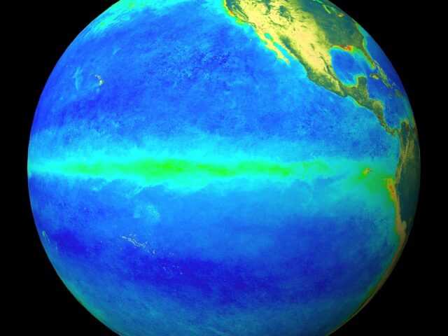
MELBOURNE, Australia – La Niña continues in the tropical Pacific. Atmospheric and oceanic indicators of the El Niño–Southern Oscillation (ENSO) reflect a mature La Niña, including tropical Pacific sea surface temperatures, the Southern Oscillation Index (SOI), and tropical cloud patterns, reports the Bureau of Meteorology of the Australian Government in its latest Climate Driver Update.
La Niña typically increases the chance of above average rainfall for northern and eastern Australia during spring and summer and the chance of warmer days and nights in northern Australia during spring.
In the Indian Ocean, the negative Indian Ocean Dipole (IOD) persists. While — for the first time since June — the latest weekly value of the IOD index is neutral (between −0.4 °C and +0.4 °C), cloud and rainfall patterns remain typical of a negative IOD. Models indicate that the IOD pattern is likely to return to neutral during December, consistent with the typical timing of an IOD breakdown. A negative IOD typically increases the chance of above average spring rainfall for most of the eastern two thirds of Australia, and the chance of warmer days and nights in northern Australia during spring.
The Southern Annular Mode (SAM) is positive and likely to continue to be positive into December. During the spring and summer months, a positive SAM increases the chance of above average rainfall for parts of eastern New South Wales, eastern Victoria, and south-eastern Queensland, and increases the chance of below average rainfall for western Tasmania.
The Madden–Julian Oscillation (MJO) is currently active over the western Pacific Ocean. Most models indicate the pulse is likely to track eastwards and weaken in coming days. The MJO’s influence at this time of year may lead to above-average rainfall for parts of north-eastern Australia, and briefly reduce the strength of equatorial trade winds west of the Date Line.
Sea surface temperatures around Australia have remained much warmer than average, with waters around Australia, in the northern tropics, and the Coral Sea setting new October records. Warmer Australian waters, especially in the tropics, can result in greater evaporation, humidity, cloudiness, and rainfall.
Climate change continues to influence Australian and global climate. Australia’s climate has warmed by around 1.47 °C over the period 1910–2020. There has also been a trend towards a greater proportion of rainfall from high intensity short duration rainfall events, especially across northern Australia.


