


The strong El Niño of 2015/16 is on the decline, and the CPC/IRI forecast says it’s likely that conditions will transition to neutral by early summer, with about a 50% chance of La Niña by the fall, according to the latest report from the National Oceanic and Atmospheric Administration (NOAA).
El Niño has begun to weaken, with sea surface temperature anomalies across most of the equatorial Pacific decreasing over the past month.

The large amount of warmer-than-average waters below the surface of the tropical Pacific (the “heat content”) also decreased sharply, despite getting a small boost in January.
The heat content is the lowest it’s been in over a year, and since the subsurface heat feeds El Niño’s warm surface waters, this is another sign that the event is tapering off.

That said, there’s still a lot of extra heat in the tropical Pacific, and we can expect El Niño’s impacts to continue around the world through the next few months.
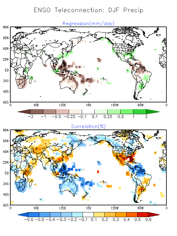
So far this winter, global rain and snow patterns have mostly been consistent with the expected patterns of El Niño, with some exceptions.
In South America, southern Uruguay, Paraguay, and southern Brazil have received much more rain than their long-term December–February average, and the northern portion of the continent has been dry, as usually occurs this time of year during El Niño.
Also consistent (so far) with El Niño’s typical impacts have been Africa’s rainfall patterns (wet in portions of Kenya and Tanzania and dry in southeastern Africa and southern Madagascar), the dryness through Indonesia and northern Australia, and the rains in southeastern China.
The precipitation impacts in North America haven’t been quite as consistent with expectations so far, although the southeast and particularly Florida have received a lot more rain than average.
Over the December–February season, the western coast of North America showed a pattern of drier north/wetter south, but the line between the two is shifted somewhat north of where it was during earlier El Niño events.
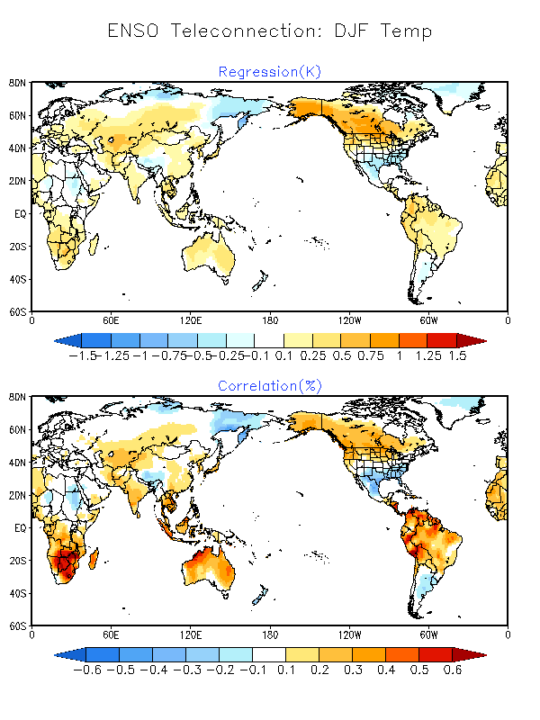
El Niño’s effect on regional temperature is a little less distinct than its effect on precipitation patterns.
Since El Niño changes the circulation of the atmosphere all around the world, it essentially changes where we expect rain to fall by steering storms to different locations. Temperature operates differently, especially since global warming is changing the averages.
Where does the 50% chance of La Niña come from? Forecasters take into consideration what happened in the past, the predictions of computer models, and current conditions when making their forecast.
La Niña conditions have followed six of the ten moderate and strong El Niños since 1950, including two of the three previous strongest El Niños.
However, this small number of cases means that it’s hard to make a very confident forecast based only on the previous events.
Next fall is still many months away, and computer climate models have a difficult time making accurate forecasts through the “spring barrier” period of March–May, which is the time of year when El Niño and La Niña are often weakening and changing into neutral.
It’s harder to predict a change in conditions. Nevertheless, most computer models are in agreement that La Niña will develop by the fall.


