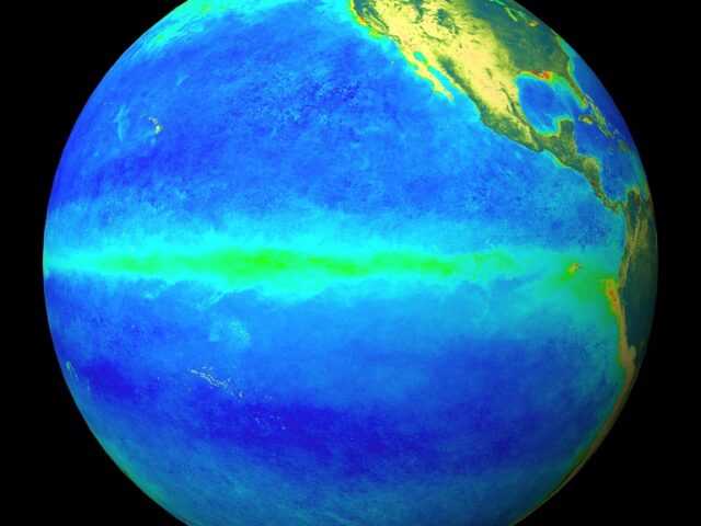
MELBOURNE, Australia – The ENSO Outlook of the Bureau of Meteorology (BoM) of the Australian Government has been raised to La Niña ALERT. This is due to both renewed cooling in the tropical Pacific Ocean as well as climate models indicating La Niña is likely during the austral spring and early summer. Historically, when La Niña ALERT criteria have been met, La Niña has subsequently developed around 70% of the time; this is approximately triple the normal likelihood.
La Niña events increase the chances of above-average rainfall for northern and eastern Australia during spring and summer.
El Niño–Southern Oscillation (ENSO) ocean indicators are currently at neutral levels but show a renewed push towards La Niña. Central tropical Pacific sea surface temperatures (SSTs) have cooled over the past six weeks, while the sub-surface has also seen recent cooling. Some atmospheric indicators, such as the Southern Oscillation Index and cloudiness near the Date Line continue to show a La Niña-like signal.
Four of seven climate models surveyed by the Bureau suggest La Niña could return by early-to-mid spring. The remaining three models maintain a neutral, though cooler than average, outlook for central Pacific SSTs for the remainder of 2022.
The negative Indian Ocean Dipole (IOD) event continues. The IOD index has been very close to or within negative IOD thresholds (i.e. at or below −0.4 °C) since early June, with the latest weekly value one of the strongest observed so far during this event. All surveyed climate models indicate that negative IOD conditions are likely to continue into late spring. A negative IOD event is typically associated with above average winter–spring rainfall for much of Australia.
The Southern Annular Mode (SAM) index is currently neutral and is likely to be mostly positive for the coming three months. During the spring months, positive SAM has a drying influence for western Tasmania, with a wetter influence for NSW and far eastern Victoria.
The Madden–Julian Oscillation (MJO) is currently weak. Several modesl suggest the MJO is likely to strengthen in the coming days over Africa or the eastern Indian Ocean and progress eastwards, with the remaining models generally remaining weak or indiscernible. While over the African and eastern Indian Ocean regions, the MJO typically increases cloudiness in the eastern Indian Ocean, and decreases cloudiness for northern parts of the Maritime Continent.
Climate change continues to influence Australian and global climate. Australia’s climate has warmed by around 1.47 °C for the 1910–2020 period. Southern Australia has seen a reduction of 10–20% in cool season (April–October) rainfall in recent decades.There has also been a trend towards a greater proportion of rainfall from high intensity short duration rainfall events, especially across northern Australia.


